
The Second World War story of the village of Oradour-sure-Glane is deeply tragic and emotive. After the destruction of the village, it's ruins were left as a memorial to those lost and a stark reminder to following generations, of the horrors that war can bring.
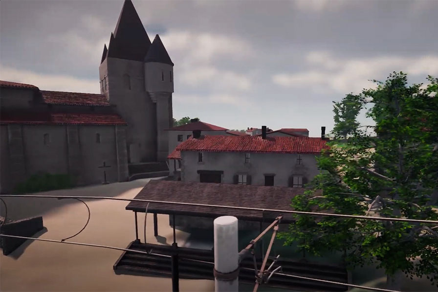
In front of the church and looking up the main street.
Through age and weathering, the buildings that remain continue to deteriorate and so it seemed a worthwhile task to try and preserve them in some way, leveraging the 3d capabilities we have access to. Attempting to create a digital version of the buildings allows us to show how the village might have appeared back in its prime. It can be difficult to connect to ruined buildings in some ways. They become monuments to the past as they fade in shape and colour. We can't always relate to them as places frequented by people like us. It can be hard to imagine these brick and stone shells once being bustling streets, markets, shops and cafés. We can sometimes lose a connection to the humanity. It's hoped that we can achieve just some of that with 3d renderings of the village as it might once have been experienced.
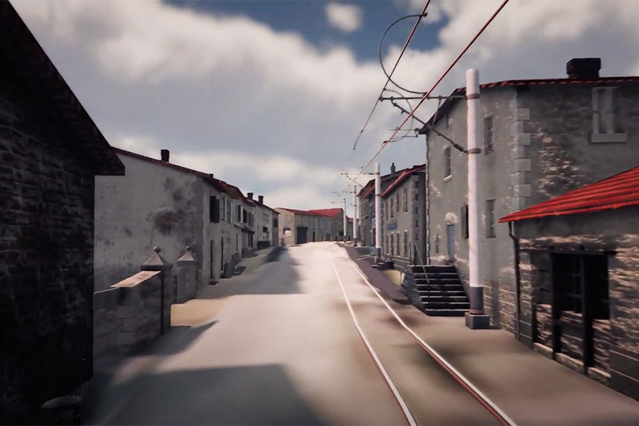
Looking down from the top of the main street.
Clear Breeze Consulting was approached by Battle Guides to re-imagine Oradour-sur-glane in digital form, to include some visual material in their upcoming documentary on the story of Oradour-sur-glane. They provided us with drone footage, video and photographic material from their own visits to the site which proved invaluable. The start of the project, the research stage, became a bit of detective work. Google maps provided a staple aerial start point and from there, it was possible to get a feel for the other dimensions from photographs and video footage.
Trawling the web for images, particularly period images of the village prior to its destruction, helped to flesh out more of the detail. Working out where various photographs were taken was quite the challenge. Becoming familiar with which shops, hotels, buildings existed and mapping those onto the current site enabled us to gradually build detail.
Each building was modelled in Cinema4d. The models were kept as low poly as possible to assist with performance. Exported fbx meshes were then textured in Substance Painter, based on studies of existing and past photographs. Where little or no information existed on certain buildings, familiarity with the subject matter allowed us to use our imagination to build something that would imply what an area might have looked like.
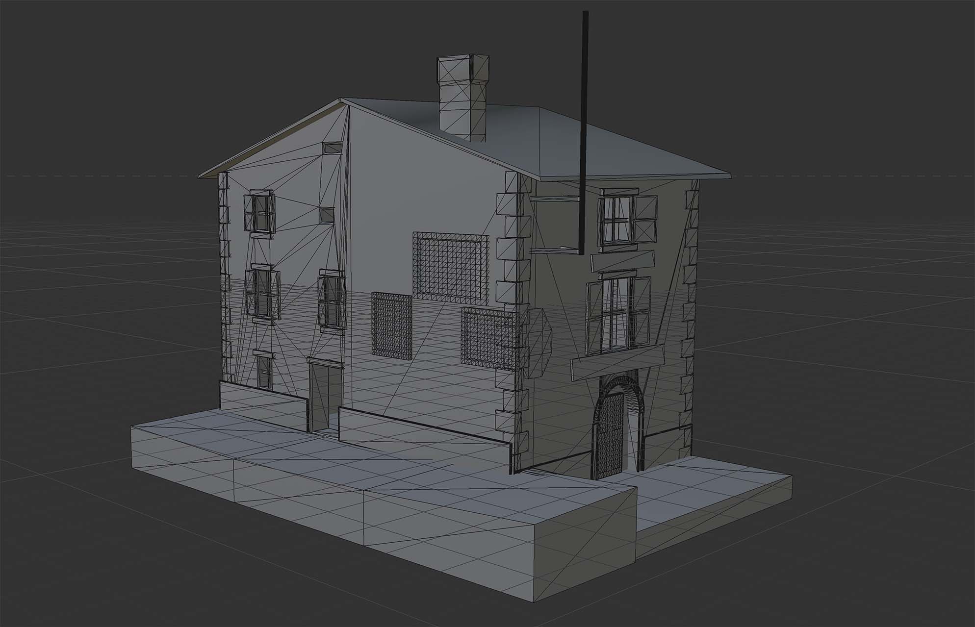
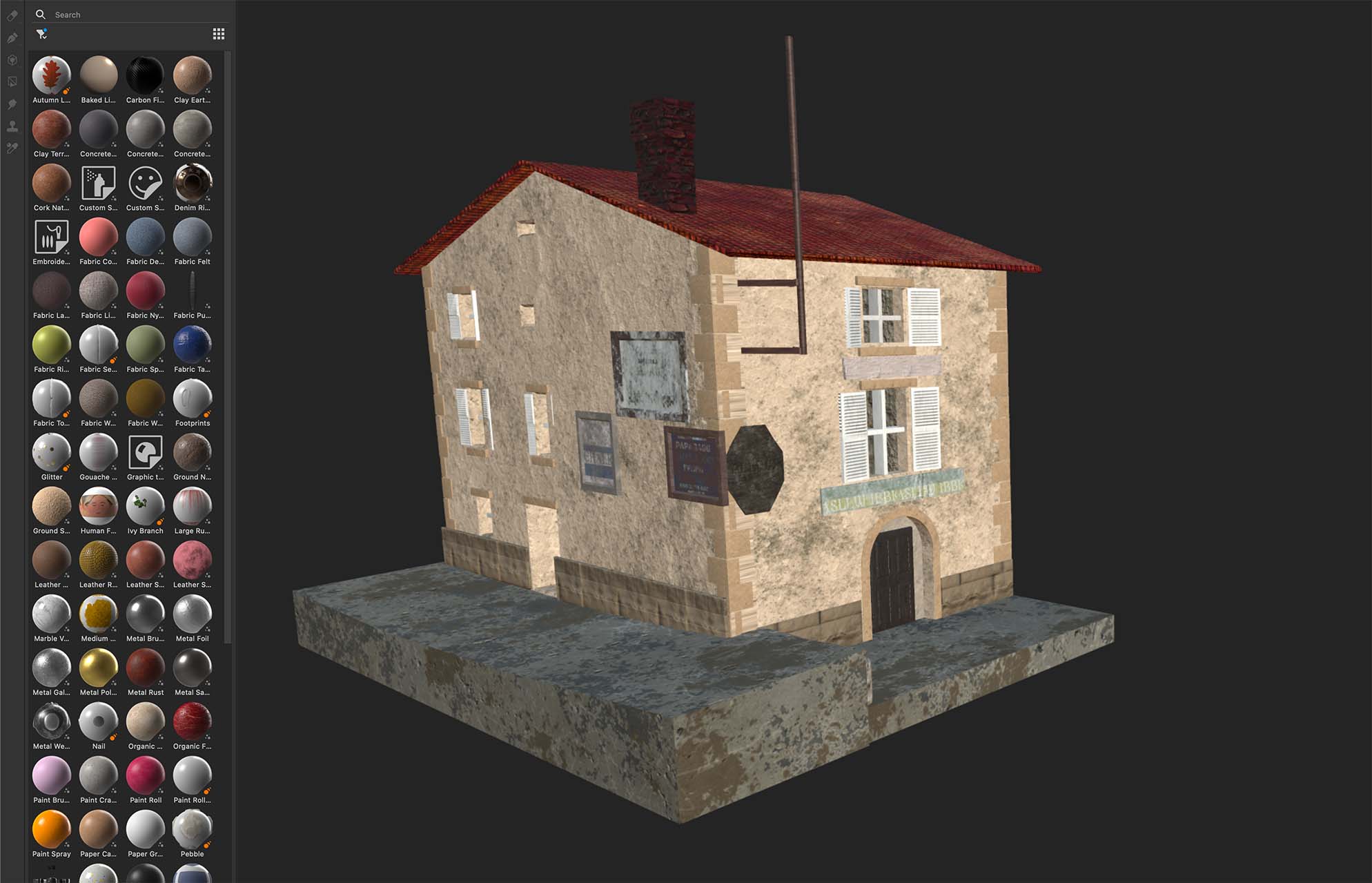
Model in C4D and texturing in Substance Painter
In the meantime, the topography of the area was generated in Unity. Lidar information was applied to Unity's landscape editor. This provided an accurate scene which accommodated hills, the river, treelines etc. A rough map of the area was overlayed to provide a plan of where to position each building. The main street climbs a gentle hill, so we needed to ensure the buildings lined this. A tramline also followed the streets, so this needed positioning accordingly.
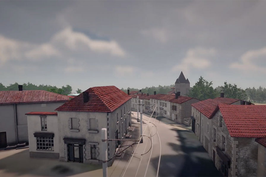
The building models, and their textures, were imported into Unity and were positioned, along with trees and other street furniture to create a sense of the town as it might have been prior to its tragic demise. There remains plenty of scope to improve on the accuracy and detail of the scene in future work.
The full documentary can be seen on Battle Guide's YouTube channel
Taking one of Batte Guide's photographs, looking down the main street towards the entrance to the village, and showing a 3d render of the recreated scene.
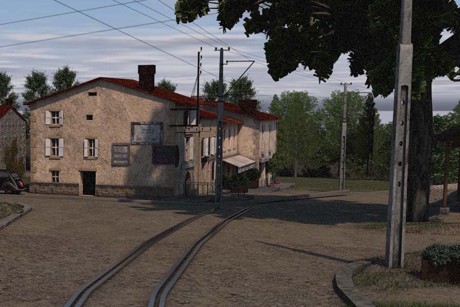
A still of the above video.