
We were approached by Battle Guide to create a 3d visual piece to support a video they were producing detailing the Battle of Rorke's Drift. The visual was to help show the layout of the complex and how it was adapted to build a defensive position as the battle played out.
It was important to the progression of the battle to accurately portray the landscape. The terrain was constructed in Unity using lidar data, with google earth information overlayed. The complex as it appears today is not fully representative of how it existed at the time of the battle and so after some research, the few buildings were modelled in Cinema4d, textured in Substance Painter and brought into Unity.
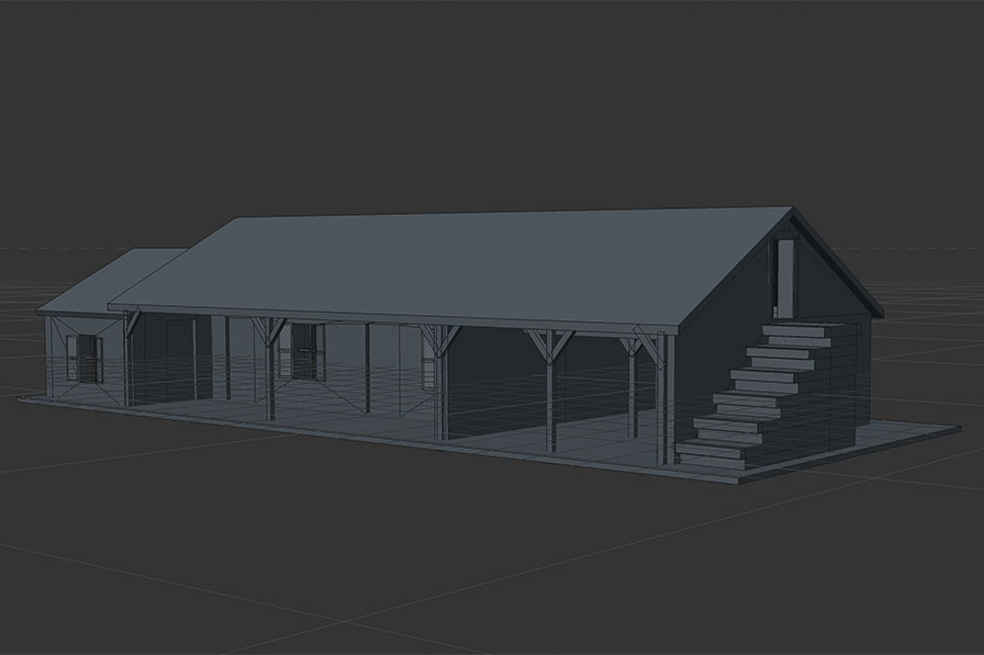
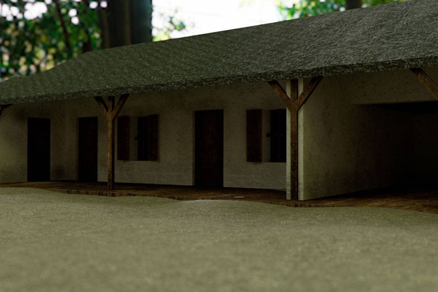
Model and render of the storehouse in Cinema4d
As well as the buildings, the surrounding landscape features were exploited for the defensive position. Natural rockfaces, walls, objects from around the site such as crates and sacks of provisions were all used by the British to fend off the Zulu warriors.
Building the scene in Unity - blocks representing the other buildings prior to completion of the models
It was important to show how all these defensive strategies came into play during the ebb and flow of the battle. Using the Pegasus plugin within Unity, the camera was set up to orbit the scene. Captions or labels were applied to the various buildings and objects within Unity to appear camera facing as the camera orbits. They also came into view as the camera approached and would disappear as it moved away.
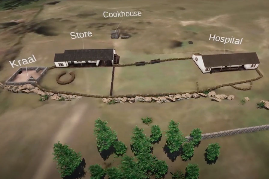
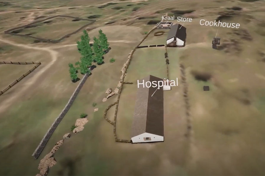
Captions/labels face the camera as it orbits around the scene
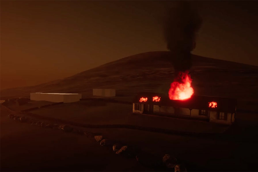
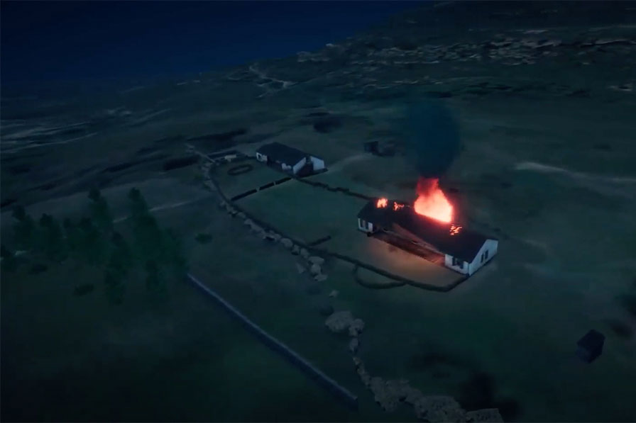
A nighttime view was also created to show how, as the battle centred on the hospital building into the night, the roof became ablaze. This allowed narrators to describe the events of the battle, accompanied by a scene displaying the key objects that influenced proceedings.
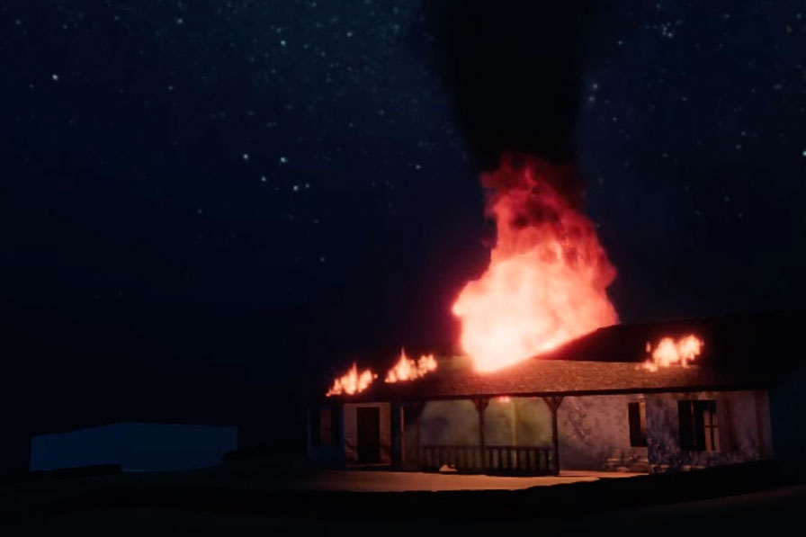
Refining the hospital fire - close-up and a still from an orbital shot
Captioned slow orbit of the site
Night orbital shot showing the hospital ablaze